API Panel.PCloud.Create
Detailed description
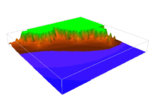
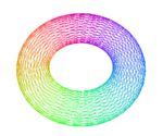
A point cloud is a series of points that can represent a graph, shape or terrain in Flowcode. All the parameters passed to this function can be altered using specific calls.
Point clouds can either be rendered using a chain of points, or a grid of points. There is no difference when displaying with Mode_Point, but for other modes a chain will render each point as though it is connected to the last, where as a grid assumes a 2-dimensional map, and connects each point to the one above and to the right of it, breaking the sequence at the end of each row of the grid.
The Pos is a position handle that the point cloud will scale to. The range of a point cloud in any axis is -1 to 1. This means that, for example -1 can be considered far left, and 1 as far right. To automatically scale a point cloud to this range, use UnitScale.
The Pos will be tracked by default. This means that the point cloud will take the shape of the position, and if that position changes at any time, the point cloud will change with it. The SetPos allows this option to be explicitly set.
Examples
Calling in a calculation
- Declare a variable 'result' of type HANDLE
- Add to a calculation icon:
result = ::Panel.PCloud.Create(pos, ::Panel.PCloud.Mode_Point, rgba)


